Filter By
95 Repositories
JavaScript Maps
Ce robot vous permettra de gérer votre serveur, avec un système d'owner, d'antiraid avancé, de logs, de gestion, de musique, d'économie...
crowbot-aoi.js by axe#1111 Ce robot vous permettra de gérer votre serveur, avec un système d'owner, d'antiraid avancé, de logs, de gestion, de musique
a roadtrip planner web application.
Rally - Roadtrip Planner Rally Map is a comprehensive web application that helps you plan your dream road trip with ease. With Rally Map, you can crea
地理坐标系转换工具
Gcoord gcoord(geographic coordinates)是一个处理地理坐标系的JS库,用来修正百度地图、高德地图及其它互联网地图坐标系不统一的问题。 支持转换坐标数组和GeoJSON数据,能在node环境以及所有现代浏览器(IE8+)中运行,gzip后仅3kb。 更多信息可以阅读地
WebGL2 powered geospatial visualization layers
deck.gl | Website WebGL2-powered, highly performant large-scale data visualization deck.gl is designed to simplify high-performance, WebGL-based visua
The smallest, simplest and fastest JavaScript pixel-level image comparison library
pixelmatch The smallest, simplest and fastest JavaScript pixel-level image comparison library, originally created to compare screenshots in tests. Fea
A very fast geospatial point clustering library for browsers and Node.

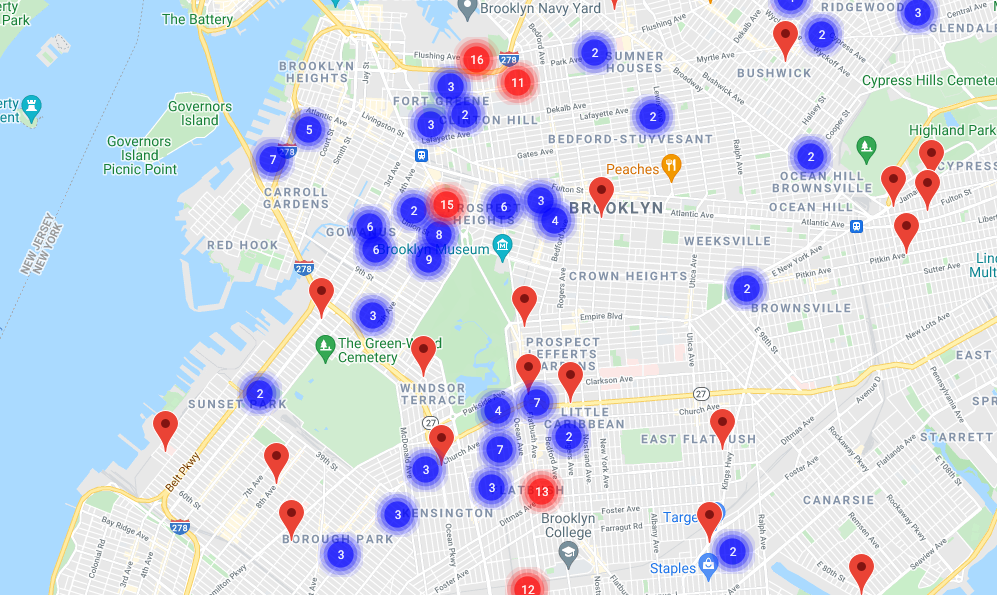
supercluster A very fast JavaScript library for geospatial point clustering for browsers and Node. script src="https://unpkg.com/[email protected]/d
OpenLayers
OpenLayers OpenLayers is a high-performance, feature-packed library for creating interactive maps on the web. It can display map tiles, vector data an
Interactive, thoroughly customizable maps in the browser, powered by vector tiles and WebGL
Mapbox GL JS is a JavaScript library for interactive, customizable vector maps on the web. It takes map styles that conform to the Mapbox Style Specif
A map tool with real-time collaboration 🗺️
Mapus Maps with real-time collaboration 🗺️ Mapus is a tool to explore and annotate collaboratively on a map. You can draw, add markers, lines, areas,
JavaScript Topology Suite
JSTS JSTS is an ECMAScript library of spatial predicates and functions for processing geometry conforming to the Simple Features Specification for SQL
Waypoints is a library that makes it easy to execute a function whenever you scroll to an element.
Waypoints Waypoints is a library that makes it easy to execute a function whenever you scroll to an element. var waypoint = new Waypoint({ element:
Asynchronous, non-blocking SQLite3 bindings for Node.js
Asynchronous, non-blocking SQLite3 bindings for Node.js. Supported platforms The sqlite3 module works with: Node.js v11.x, v12.x, v13.x and v14.x. Ele
React components for Leaflet maps
React Leaflet React components for Leaflet maps. Documentation Getting started API reference Changes See the CHANGELOG file. Contributing See the CONT
Visualization of all roads within any city
city-roads Render every single road in any city at once: https://anvaka.github.io/city-roads/ How it is made? The data is fetched from OpenStreetMap u
An open-source JavaScript library for world-class 3D globes and maps :earth_americas:

CesiumJS is a JavaScript library for creating 3D globes and 2D maps in a web browser without a plugin. It uses WebGL for hardware-accelerated graphics
🖼️ Create beautiful maps from OpenStreetMap data in a webapp

prettymapp 🖼️ Prettymapp is a webapp to create beautiful maps from OpenStreetMap data (based on prettymaps) 🎈 Try it out here: prettymapp on streaml
React friendly API wrapper around MapboxGL JS
react-map-gl | Docs react-map-gl is a suite of React components designed to provide a React API for Mapbox GL JS-compatible libraries. More informatio
Medium's Image Zoom for jQuery
ZOOM.JS A simple jQuery plugin for image zooming; as seen on Medium. Demo https://fat.github.io/zoom.js How Link the zoom.js and zoom.css files to you
Tools for editing Shapefile, GeoJSON, TopoJSON and CSV files
Mapshaper Introduction Mapshaper is software for editing Shapefile, GeoJSON, TopoJSON, CSV and several other data formats, written in JavaScript. Maps
Mind elixir is a free open source mind map core.

Mind-elixir is a framework agnostic mind map core
Draw tools for mapbox-gl-js
@mapbox/mapbox-gl-draw Adds support for drawing and editing features on mapbox-gl.js maps. See a live example here Requires mapbox-gl-js. Compatible v
The NASA WorldWind Javascript SDK (WebWW) includes the library and examples for creating geo-browser web applications and for embedding a 3D globe in HTML5 web pages.
Web WorldWind New versions of WorldWind released Web WorldWind 0.10.0 and WorldWind Java 2.2.0 are now available on GitHub. The new version of Web Wor
:leaves: JavaScript library for mobile-friendly interactive maps
Leaflet is the leading open-source JavaScript library for mobile-friendly interactive maps. Weighing just about 39 KB of gzipped JS plus 4 KB of gzipp
3D web map rendering engine written in TypeScript using three.js

3D web map rendering engine written in TypeScript using three.js
zoom in on any element in the DOM
zoom.js Enables a minimal JS API for zooming in on specific points or DOM elements. Note that this is only a proof of concept so don't use it for anyt
A pluggable Node.js map tile server.
TileStrata TileStrata is a pluggable "slippy map" tile server that emphasizes code-as-configuration. The primary goal is painless extendability. It's
A web based data mining tool for OpenStreetMap using the Overpass API.
overpass turbo https://overpass-turbo.eu/ – stable version https://tyrasd.github.io/overpass-turbo/ – latest version This is a GUI for testing and dev
A simple web extension that redirects Twitter, YouTube, Instagram & Google Maps requests to privacy friendly alternatives.

Get Donate FIRO aEyKPU7mwWBYRFGoLiUGeQQybyzD8jzsS8 BTC: 3JZWooswwmmqQKw5iW6AYFfK5gcWTrvueE ETH: 0x90049dc59365dF683451319Aa4632aC61193dFA7 About A web
Interactive map overlay for finding secrets hidden around the world of Lost Ark.

Lostark Map Overlay This is an interactive map overlay which is resizable, movable and can be kept up during gameplay for finding secrets hidden aroun
MERN stack travel app using mapbox API, Travel and drop pin , share reviews and rate the location

MERN-Travel-Map Travel Map Pin A single page application built with MERN Stack from scratch (MongoDB + Mongoose, Express, React & NodeJs) Table of Con
Vue 2 components for Leaflet maps
Vue2Leaflet Vue2Leaflet is a JavaScript library for the Vue framework that wraps Leaflet making it easy to create reactive maps. How to install npm in
jQuery Vector Map Library
This project is a heavily modified version of jVectorMap as it was in April of 2012. I chose to start fresh rather than fork their project as my inten
jQuery Vector Map Library
This project is a heavily modified version of jVectorMap as it was in April of 2012. I chose to start fresh rather than fork their project as my inten
A simple JSONP implementation
jsonp A simple JSONP implementation. Installation Install for node.js or browserify using npm: $ npm install jsonp Install for component(1) using comp
the easiest way to use Google Maps
Important If you're developer, I'm moving gmaps.js to NPM, you can give your opinion and check the migration progress in Issue #404 gmaps.js - A Javas
JavaScript library to transform coordinates from one coordinate system to another, including datum transformations
PROJ4JS Proj4js is a JavaScript library to transform point coordinates from one coordinate system to another, including datum transformations. Origina
Dashboards-maps is a frontend plugin that helps you in uploading custom GeoJSON to OpenSearch and communicates with the geospatial backend plugin for the same.
Welcome! Project Resources Code of Conduct License Copyright Dashboards-Maps Dashboards-maps is a frontend plugin that helps you in uploading custom G
A Google Earth Engine tool for identifying satellite radar interference
Many military radars interfere with open source satellite imagery when they're turned on. A new tool lets anyone monitor when and where these radars a
Create and manage clusters for large amounts of markers

Google Maps JavaScript MarkerClusterer Description The library creates and manages per-zoom-level clusters for large amounts of markers. See the histo
Vuejs 2 components for interacting with mapbox-gl-js
VueMapbox Combine powers of Vue.js and Mapbox Gl JS Vue-mapbox is wrapper around Mapbox GL JS library that provides vueish-way to interact with the ma
great circle routes in javascript
arc.js Calculate great circles routes as lines in GeoJSON or WKT format. Algorithms from https://edwilliams.org/avform.htm#Intermediate Includes basic
An open-source JavaScript library for world-class 3D globes and maps :earth_americas:

CesiumJS is a JavaScript library for creating 3D globes and 2D maps in a web browser without a plugin. It uses WebGL for hardware-accelerated graphics
Satellite imagery annotation tool

Satellite imagery annotation tool This is a lightweight web-interface for creating and sharing vector annotations over satellite/aerial imagery scenes
Add time dimension capabilities on a Leaflet map.

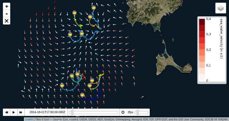
Leaflet TimeDimension Add time dimension capabilities on a Leaflet map. Examples and basic usage API L.Map L.TimeDimension L.TimeDimension.Layer L.Tim
Polymaps is a free JavaScript library for making dynamic, interactive maps in modern web browsers.
Polymaps Polymaps is a free JavaScript library for making dynamic, interactive maps in modern web browsers. See http://polymaps.org for more details.
Mapbox JavaScript API, a Leaflet Plugin
mapbox.js A Mapbox plugin for Leaflet, a lightweight JavaScript library for traditional raster maps. For the state-of-the-art Mapbox vector maps libra
Serverless raster and vector map tile generation using Mapnik and AWS Lambda
tilegarden 🗺️ 🌻 Contents About Usage Deployment to AWS Additional Configuration Options Required AWS Permissions Features Configuration Selection an
A Node.js map tile library for PostGIS and torque.js, with CartoCSS styling

Windshaft A Node.js map tile library for PostGIS and torque.js, with CartoCSS styling. Can render arbitrary SQL queries Generates image and UTFGrid in
geotiff.js is a small library to parse TIFF files for visualization or analysis. It is written in pure JavaScript, and is usable in both the browser and node.js applications.
geotiff.js Read (geospatial) metadata and raw array data from a wide variety of different (Geo)TIFF files types. Features Currently available function
Blazing Fast JavaScript Raster Processing Engine
Geoblaze A blazing fast javascript raster processing engine Geoblaze is a geospatial raster processing engine written purely in javascript. Powered by
Terra development environment for better smart contract development experience.

Terrain Terrain – Terra development environment for better smart contract development experience Terrain will help you: scaffold your dapp project eas
Lightweight Node.js isochrone map server

Galton Lightweight Node.js isochrone server. Build isochrones using OSRM, Turf and concaveman. Francis Galton is the author of the first known isochro
Converts geojson to svg string given svg viewport size and maps extent.
geojson2svg Converts geojson to svg string given svg viewport size and maps extent. Check world map, SVG scaled map and color coded map examples to de