53 Repositories
JavaScript maps Libraries
A store locator plugin using Google Maps API version 3
jQuery Google Maps Store Locator Plugin The files you're looking for are in the dist/ directory Please see my blog for more information and examples.
💄 An app to create, edit, and preview HDR environment maps in the browser
Environment Map Light Editor Create, edit, and preview HDR environment maps in the browser. Preview your models in realtime and export lightmaps to us
Front-End mentor project for rest maps API😊👍

REST Countries API with color theme switcher Live | Solution | Challenge Solution for a challenge from frontendmentor.io. About The Project If you're
Simple location picker on Leaflet map
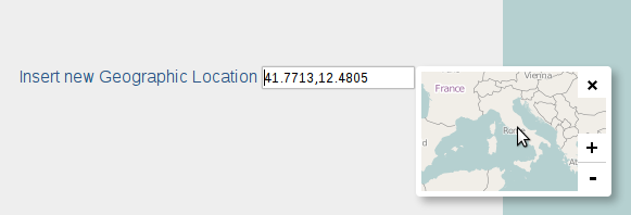
Leaflet Location Picker Simple location picker with Leaflet map Usage: labelInsert a Geo Location input id="geoloc" type="text" value="" / /lab
jQuery plugin for enhancing HTML Image maps
ImageMapster: A jQuery Plugin to make image maps useful ImageMapster activates the areas in HTML imagemaps so you can highlight and select them. It ha
simple jquery Plugin that utilizes Google API to get data from a Place on Google Maps
jQuery Plugin to display Google Reviews of a Place on Google Maps this will get the 5 reviews, google offers you. But I need more than 5 reviews! if y
A lightweight JavaScript library for creating interactive maps and pretty data visualization.

Jsvectormap A lightweight Javascript library for creating interactive maps and pretty data visualization. Explore docs . Report bug · View demo · Down
Cross provider map drawing library, supporting Mapbox, Google Maps and Leaflet out the box
Terra Draw Frictionless map drawing across mapping providers. TerraDraw centralises map drawing logic and provides a host of out the box drawing modes
Application which will allow users to find hotels, hostels and restaurants and feedback about those in whole over of world.
Gatsby minimal TypeScript starter 🚀 Quick start Create a Gatsby site. Use the Gatsby CLI to create a new site, specifying the minimal TypeScript star
Interactive, thoroughly customizable maps in the browser, powered by vector tiles and WebGL
Mapbox GL JS is a JavaScript library for interactive, customizable vector maps on the web. It takes map styles that conform to the Mapbox Style Specif
Change import URLs in JavaScript code using import maps. e.g. `import * from "before"` to `import * from "after"`
esm-import-transformer Can transform any ESM source code import URLs using an import maps object. This package works in ES modules or in CJS. // Befor
Bertin.js is a JavaScript library for visualizing geospatial data and make thematic maps for the web.

Bertin.js is a JavaScript library for visualizing geospatial data and make thematic maps for the web. The project is under active development. Some of
Dashboards-maps is a frontend plugin that helps you in uploading custom GeoJSON to OpenSearch and communicates with the geospatial backend plugin for the same.
Welcome! Project Resources Code of Conduct License Copyright Dashboards-Maps Dashboards-maps is a frontend plugin that helps you in uploading custom G
🙃 Life is too short to set-up an account on GCP

Google no-API tools 🙃 Life is too short to set-up an account on GCP Install npm i @brunoluiz/google-no-api-tools # or yarn add @brunoluiz/google-no-a
A Travel companion app using Google Maps API, Travel Search and Weather API

Travel Advisor Introduction An advanced Travel Companion Application using Google Maps. With Geolocation, Google Maps API, Searching for places, Fetch
It's a javascript Class which contains utility methods that simplify working with google maps web SDK
About GoogleMapsJSHelper It's a javascript Class which contains utility methods that simplify working with google maps web SDK Note: i used ES7 Class
A landing page, as well as a results page, that utliize both Yelp API and Google Maps API.
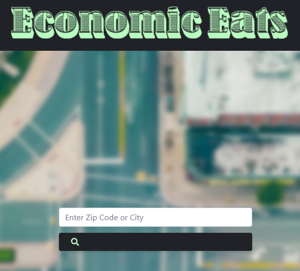
Economic Eats Group Project #1 Maintained By: Austin Donovan John Hysong John Guzzetta Jahnathan Exantus Description This project contains a landing p
View maps, graphs, and tables of your save and compete in a casual, evergreen leaderboard of EU4 achievement speed runs. Upload and share your save with the world.

PDX Tools PDX Tools is a modern EU4 save file analyzer that allow users to view maps, graphs, and data tables of their save all within the browser. If
:ukraine: A self-hosted app for keeping track of employee wellbeing and dislocation during the Russo-Ukrainian war, with an interactive map.
Helping organizations stay together and help their members in times of disaster On February 24th, 2022, the lives of the entire Ukrainian nation were
🖼️ Create beautiful maps from OpenStreetMap data in a webapp

prettymapp 🖼️ Prettymapp is a webapp to create beautiful maps from OpenStreetMap data (based on prettymaps) 🎈 Try it out here: prettymapp on streaml
Utility for generating preview images of StarCraft: Brood War and Remastered maps
bwpreview Utility for generating preview images of StarCraft: Brood War and Remastered maps (.scm and .scx files). All of the actual work of parsing m
A fleet management Application built with the service providers and user in mind

A fleet management Application built with the service providers and user in mind. A multi faceted Admin and consumer console application for mobile.
An online tool to generate and visualize maps for irregular and/or gapped LED layouts, for use with FastLED, Pixelblaze and other libraries.

An online tool to generate and visualize maps for irregular and/or gapped LED layouts, for use with FastLED, Pixelblaze and other libraries.
Svaasthy project - a part of the Electrothon-4.0 Hackathon

Svaasthy View the presentaton The problems we address... The covid-19 crisis is drawing attention to the already overburdened public health systems in
Crowdsource and crowdfund collaboration on maps of problems.
Getting Started with Create React App This project was bootstrapped with Create React App. Available Scripts In the project directory, you can run: np
Chart.js Choropleth and Bubble Maps
Chart.js Geo Chart.js module for charting maps with legends. Adding new chart types: choropleth and bubbleMap. works great with https://github.com/cha
A simple web extension that redirects Twitter, YouTube, Instagram & Google Maps requests to privacy friendly alternatives.
Get Donate FIRO aEyKPU7mwWBYRFGoLiUGeQQybyzD8jzsS8 BTC: 3JZWooswwmmqQKw5iW6AYFfK5gcWTrvueE ETH: 0x90049dc59365dF683451319Aa4632aC61193dFA7 About A web
Google-reviews-crawler - A simple Playwright crawler that stores Google Maps Place/Business reviews to a JSON file.
google-reviews-crawler A simple Playwright crawler that stores Google Maps Place/Business reviews to a JSON file. Usage Clone the repo, install the de
Downloads satellite images from Google Maps, only slightly illegal.
Google Maps Satellite Downloader This is a script to download satellite images from Google Maps. The below mentioned optimization system requires that
Create and manage clusters for large amounts of markers
Google Maps JavaScript MarkerClusterer Description The library creates and manages per-zoom-level clusters for large amounts of markers. See the histo
A map tool with real-time collaboration 🗺️
Mapus Maps with real-time collaboration 🗺️ Mapus is a tool to explore and annotate collaboratively on a map. You can draw, add markers, lines, areas,
Cool tips to design UI/UX on Leaflet maps.

Map Effects 100 Map Effects 100 has cool tips to design UI/UX on your Map. Map? Leaflet Quick Start git clone https://github.com/muxlab/map-effects-10
A pluggable Node.js map tile server.
TileStrata TileStrata is a pluggable "slippy map" tile server that emphasizes code-as-configuration. The primary goal is painless extendability. It's
AngularJS directive to embed an interact with maps managed by Leaflet library
Angular Leaflet Why the fork? While we are grateful for all the original work at tombatossals/angular-leaflet-directive. We need to be able to operate
Add time dimension capabilities on a Leaflet map.
Leaflet TimeDimension Add time dimension capabilities on a Leaflet map. Examples and basic usage API L.Map L.TimeDimension L.TimeDimension.Layer L.Tim
A very fast geospatial point clustering library for browsers and Node.

supercluster A very fast JavaScript library for geospatial point clustering for browsers and Node. script src="https://unpkg.com/[email protected]/d
Blazing Fast JavaScript Raster Processing Engine
Geoblaze A blazing fast javascript raster processing engine Geoblaze is a geospatial raster processing engine written purely in javascript. Powered by
Converts geojson to svg string given svg viewport size and maps extent.
geojson2svg Converts geojson to svg string given svg viewport size and maps extent. Check world map, SVG scaled map and color coded map examples to de
Vue 2 components for Leaflet maps

Vue2Leaflet Vue2Leaflet is a JavaScript library for the Vue framework that wraps Leaflet making it easy to create reactive maps. How to install npm in
React components for Leaflet maps
React Leaflet React components for Leaflet maps. Documentation Getting started API reference Changes See the CHANGELOG file. Contributing See the CONT
This project contains the TypeScript definitions for the Bing Maps V8 Web Control.

Bing Maps V8 TypeScript Definitions These are the official TypeScript definitions for the Bing Maps V8 Web Control. These can be used to provide intel
This is a collection of over two hundred code samples an growing for the Bing Maps V8 web control.
Bing Maps V8 Code Samples This is a collection of over a hundred code samples for the Bing Maps V8 web control. These samples have been collected from
the easiest way to use Google Maps
Important If you're developer, I'm moving gmaps.js to NPM, you can give your opinion and check the migration progress in Issue #404 gmaps.js - A Javas
jQuery plugin based on raphael.js that allows you to display dynamic vector maps
jQuery Mapael - Dynamic vector maps The complete documentation is available on Mapael website (repository: 'neveldo/mapael-documentation'). Additional
An open-source JavaScript library for world-class 3D globes and maps :earth_americas:
CesiumJS is a JavaScript library for creating 3D globes and 2D maps in a web browser without a plugin. It uses WebGL for hardware-accelerated graphics
OpenLayers
OpenLayers OpenLayers is a high-performance, feature-packed library for creating interactive maps on the web. It can display map tiles, vector data an
UNMAINTAINED Open source JavaScript renderer for Kartograph SVG maps
This project is not maintained anymore. Here are a few reasons why I stopped working on kartograph.js: there's no need to support non-SVG browsers any
Polymaps is a free JavaScript library for making dynamic, interactive maps in modern web browsers.
Polymaps Polymaps is a free JavaScript library for making dynamic, interactive maps in modern web browsers. See http://polymaps.org for more details.
the easiest way to use Google Maps
Important If you're developer, I'm moving gmaps.js to NPM, you can give your opinion and check the migration progress in Issue #404 gmaps.js - A Javas
An open-source JavaScript library for world-class 3D globes and maps :earth_americas:
CesiumJS is a JavaScript library for creating 3D globes and 2D maps in a web browser without a plugin. It uses WebGL for hardware-accelerated graphics
:leaves: JavaScript library for mobile-friendly interactive maps
Leaflet is the leading open-source JavaScript library for mobile-friendly interactive maps. Weighing just about 39 KB of gzipped JS plus 4 KB of gzipp
Beautiful React SVG maps with d3-geo and topojson using a declarative api.
react-simple-maps Create beautiful SVG maps in react with d3-geo and topojson using a declarative api. Read the docs, or check out the examples. Why R
🔥 JavaScript Library for HTML5 canvas based heatmaps
heatmap.js Dynamic Heatmaps for the Web. How to get started The fastest way to get started is to install heatmap.js with bower. Just run the following